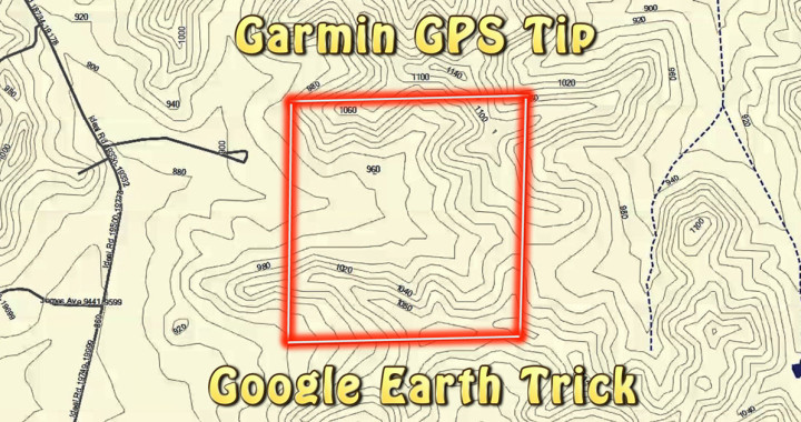
Here’s a quick and easy tip to add property lines to your GPS. It works great for marking lines on obscure or not well known public access areas, which often change year by year or simply aren’t included on the larger GPS map downloads. In addition, this is a great option for marking boundaries on private land, since they are almost never included on GPS downloads apart from expensive plat map downloads and SD cards.
As far as I’m aware, these Garmin GPS property boundaries only work with the Garmin brand of GPS. However, that’s not to say it won’t work with other brands; I simply haven’t had the opportunity to test them. Leave a comment if you try this with another brand! It would be great to know if it works. By the way, if you’re curious about the particular model I use, it’s the Garmin GPSMAP 62s. I did a review on it here: Garmin GPSMAP 62s GPS Review.
Unfortunately, what this trick doesn’t work well for is adding massive numbers of property boundaries, such as what you’d see in a plat book. For that kind of detail on your GPS, you need to purchase a plat map application. What I typically do, however, is go to the county website. Usually, they will display public information on properties. My favorite way to find this information is to go to Google and search “County (Insert County Name Here) GIS”. Often there’s an interactive map with property lines, information, and the ability to overlay aerial photos.